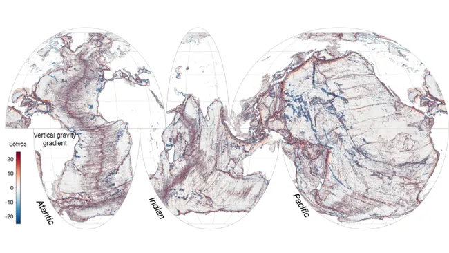
A new satellite called the Surface Water and Ocean Topography (SWOT) satellite has mapped the Earth’s seafloors in unprecedented detail.
In just its first year of operation, the SWOT satellite has provided more detailed information about the seafloor than 30 years of data collected by older satellites.
The SWOT satellite measures the height of the ocean surface, which reflects the gravitational pull of underwater features like hills and volcanoes. This allows it to map small abyssal hills, seamounts, and continental margins that were previously undetected.
The new seafloor data provides insights into plate tectonic movements, ocean currents, nutrient transport, and the geologic history of the oceans.
Researchers were surprised to see so many small abyssal hills and seamounts that were previously unknown. The data is helping to refine maps of tectonic boundaries and coastal ocean currents.
Over the remainder of its 3-year mission, the SWOT satellite will continue collecting detailed data on ocean currents, seafloor features, and global freshwater resources.
Source: livescience


